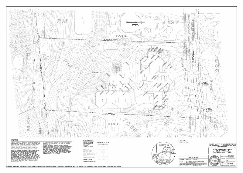


• Topographic Surveys and Mapping
Total Station
Aerial Photography
Photo Control
• ALTA Surveys
• Property and Boundary Surveys
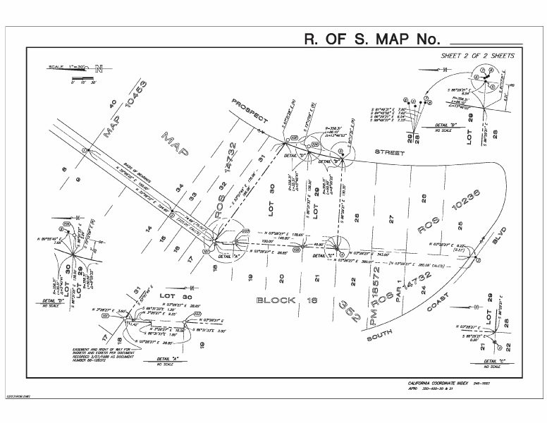
Records-of-Survey
Corner Records
• Tract Surveying and Mapping
Subdivisions and Parcel Maps
Lot Line Adjustments
Lot Consolidation Parcel Map
• Condominium Plans
• Route Surveys
Centerline and Cross Sections
• Construction Staking and Control
• Test Boring, Septic System & Well Locations
• Final Lot and Building Elevation Certifications
• As-Built Surveys and Drawings
• View Easements & Utility Easement Surveys
Plats and Exhibits
Legal Descriptions
• Monitoring Surveys
Surveying and Mapping is provided to the Client in a professional and efficient manner using the latest in methods and equipment including CADD and COGO computer programs, GPS and Total Station equipment.

Surveying is both a stand-alone service and part of a more complex project. Stand-alone projects include lot surveys, easements, lot line adjustments and subsidence monitoring. More complex projects such a building or subdivision require services throughout the project beginning with a topographic model of the land as a base model for the Design Team and ending with the final building or lot certification. The type of survey equipment depends on the project but we can provide the needed equipment and personnel for simple or complex jobs, total station lot surveys to GPS networks. Some of our Surveying services: